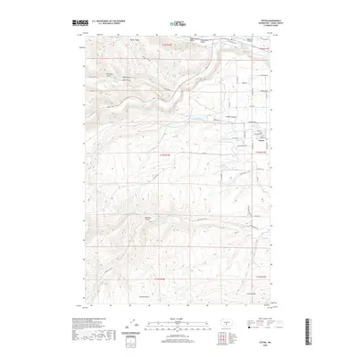
2020 Map of Tieton
USGS Topo · Published 2020About this map
The settlement of Tieton stands as a focal point of irrigation-driven geography in Yakima County, defined by its complex network of waterways. Water management is the primary narrative of this landscape, as seen in the Wapatox Canal near the Naches River and the extensive Yakima Tieton Main Canal that skirts the southern foothills. These engineering works facilitate agriculture in an area otherwise dominated by the high-relief terrain of Bethel Ridge to the north and Cowiche Mtn to the south.
Find a feature on this map
51 named features on this map. Tap any name to fly to it.
Don’t see what you’re looking for? This feature index may not catch every label — zoom into the map to look around manually.
Map Details
Editions of this 2020 Tieton Map
This is the sole edition of this map. No revisions or reprints were ever made.
Other maps of this area

1899 · Ellensburg
USGS Topo · 1:125,000

1901 · Ellensburg
USGS Topo · 1:125,000

1950 · Yakima
USGS Topo · 1:250,000

1958 · Ellensburg
USGS Topo · 1:62,500

1958 · Wiley City
USGS Topo · 1:24,000

1958 · Naches
USGS Topo · 1:24,000

1958 · Yakima
USGS Topo · 1:250,000

1961 · Yakima
USGS Topo · 1:250,000

1971 · Nile
USGS Topo · 1:24,000
1971 · Milk Canyon
USGS Topo · 1:24,000