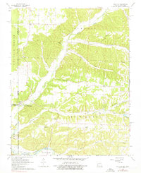
1965 Map of Tiff City
USGS Topo · Published 1976About this map
Tiff City serves as a local focal point in this mid-1960s study of the Missouri-Oklahoma borderlands. The landscape is defined by the winding paths of Buffalo Creek and Patterson Creek, which cut through the Ozark terrain to create distinctive features like Owens Bluff and Kinslow Hollow. For genealogists and local historians, the map is remarkably dense with family-named landmarks and rural institutions, including the Hart Sch and numerous community centers of worship such as Cedar Point Ch, Lone Star Ch, and Pleasant Grove Ch.
Find a feature on this map
35 named features on this map. Tap any name to fly to it.
Don’t see what you’re looking for? This feature index may not catch every label — zoom into the map to look around manually.
Map Details
Editions of this 1965 Tiff City Map
3 editions found
Other maps of this area

1907 · Wyandotte
USGS Topo · 1:125,000

1909 · Wyandotte
USGS Topo · 1:125,000

1916 · Neosho
USGS Topo · 1:62,500

1940 · Noel
USGS Topo · 1:62,500

1943 · Noel
USGS Topo · 1:62,500

1949 · Seneca
USGS Topo · 1:24,000

1950 · Seneca
USGS Topo · 1:24,000

1954 · Tulsa
USGS Topo · 1:250,000

1958 · Tulsa
USGS Topo · 1:250,000

1961 · Wyandotte
USGS Topo · 1:24,000