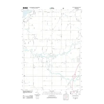
2012 Map of Tift Corner
USGS Topo · Published 2012About this map
Little Muskegon River meanders through the heart of this landscape, its winding course defining the rural character of this Newaygo County region in the early 21st century. The map centers on the small settlement of Tift Corner and the northern community of Oxbow, situated near the expanse of Hardy Dam Pond. This survey provides essential detail for family historians, documenting several local burial grounds including Gulp Cem, Prairie Cem, and the Christian Plains Cem.
Find a feature on this map
79 named features on this map. Tap any name to fly to it.
Don’t see what you’re looking for? This feature index may not catch every label — zoom into the map to look around manually.
Map Details
Editions of this 2012 Tift Corner Map
This is the sole edition of this map. No revisions or reprints were ever made.
Other maps of this area

1954 · Midland
USGS Topo · 1:250,000

1958 · Midland
USGS Topo · 1:250,000

1958 · Sand Lake
USGS Topo · 1:62,500

1958 · Woodville
USGS Topo · 1:62,500

1958 · Big Rapids
USGS Topo · 1:62,500

1959 · Midland
USGS Topo · 1:250,000

1959 · Howard City
USGS Topo · 1:62,500

1966 · Midland
USGS Topo · 1:250,000

1976 · Big Rapids SW
USGS Topo · 1:24,000
1976 · Howard City NW
USGS Topo · 1:24,000