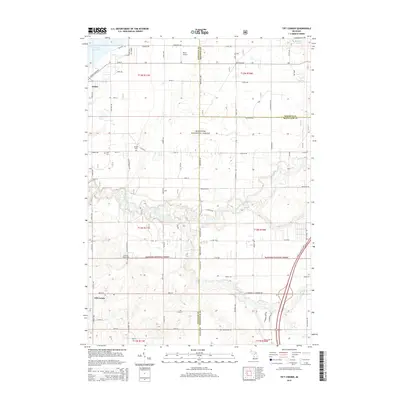
2014 Map of Tift Corner
USGS Topo · Published 2014About this map
The Little Muskegon River meanders through the heart of this landscape, its path cutting through the southern reaches of the Manistee National Forest. This section of West Michigan is defined by the intersection of three counties, where Newaygo, Mecosta, and Montcalm meet. The terrain is characterized by a high density of small water bodies and drainage systems, including Tamarack Creek, Handy Creek, and Rice Creek.
Find a feature on this map
54 named features on this map. Tap any name to fly to it.
Don’t see what you’re looking for? This feature index may not catch every label — zoom into the map to look around manually.
Map Details
Editions of this 2014 Tift Corner Map
This is the sole edition of this map. No revisions or reprints were ever made.
Other maps of this area

1954 · Midland
USGS Topo · 1:250,000

1958 · Midland
USGS Topo · 1:250,000

1958 · Sand Lake
USGS Topo · 1:62,500

1958 · Woodville
USGS Topo · 1:62,500

1958 · Big Rapids
USGS Topo · 1:62,500

1959 · Midland
USGS Topo · 1:250,000

1959 · Howard City
USGS Topo · 1:62,500

1966 · Midland
USGS Topo · 1:250,000

1976 · Big Rapids SW
USGS Topo · 1:24,000
1976 · Howard City NW
USGS Topo · 1:24,000