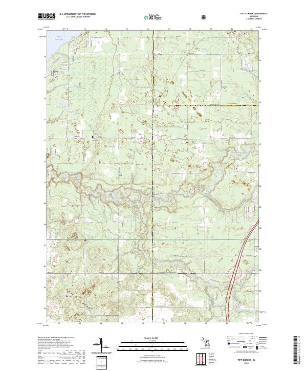
2023 Map of Tift Corner
USGS Topo · Published 2023About this map
Manistee National Forest dominates the central landscape of this West Michigan survey, where the borders of Newaygo, Mecosta, and Montcalm counties converge. The geography is defined by a dense network of water, with the Little Muskegon River and its tributaries, Tamarack Creek and Handy Creek, cutting through the terrain. To the northwest, the map shows the settlement of Oxbow near the expansive Hardy Dam Pond. For those researching local lineages, several burial grounds are documented, including Stearns Prairie Cem, Culp Cem, and Christian Plains Cem. The land is gridded by rural roads like Chestnut Ave and Cottonwood Ave, illustrating the transition from managed forest lands to the agricultural and residential plots that characterize this corner of the state.
Find a feature on this map
83 named features on this map. Tap any name to fly to it.
Don’t see what you’re looking for? This feature index may not catch every label — zoom into the map to look around manually.
Map Details
Editions of this 2023 Tift Corner Map
This is the sole edition of this map. No revisions or reprints were ever made.
Other maps of this area

1954 · Midland
USGS Topo · 1:250,000

1958 · Midland
USGS Topo · 1:250,000

1958 · Sand Lake
USGS Topo · 1:62,500

1958 · Woodville
USGS Topo · 1:62,500

1958 · Big Rapids
USGS Topo · 1:62,500

1959 · Midland
USGS Topo · 1:250,000

1959 · Howard City
USGS Topo · 1:62,500

1966 · Midland
USGS Topo · 1:250,000

1976 · Big Rapids SW
USGS Topo · 1:24,000
1976 · Howard City NW
USGS Topo · 1:24,000