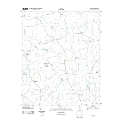
2011 Map of Tigerville
USGS Topo · Published 2011About this map
Campbell Covered Bridge serves as a prominent landmark in this corner of the South Carolina upstate, where the Middle Tyger River and South Tyger River carve through the foothills. The landscape is dotted with small rural settlements like Highland, Tigerville, and Lendaw, connected by historical routes including Old Highway 11. This area is characterized by its numerous small-scale reservoirs and dammed ponds, such as Berrys Millpond and Sudduth Pond, which speak to a long history of local water management and early milling operations. Higher elevations like Pax Mountain and Glassy overlook a dense network of family-named cemeteries, including Bartons Memorial Chapel Cemetery and Gum Springs Cemetery, providing critical spatial data for genealogists tracing lineage through these local congregations.
Find a feature on this map
166 named features on this map. Tap any name to fly to it.
Don’t see what you’re looking for? This feature index may not catch every label — zoom into the map to look around manually.
Map Details
Editions of this 2011 Tigerville Map
This is the sole edition of this map. No revisions or reprints were ever made.
Other maps of this area

1907 · Saluda
USGS Topo · 1:125,000

1935 · Greer
USGS Topo · 1:48,000

1935 · Greenville
USGS Topo · 1:48,000

1935 · Zirconia
USGS Topo · 1:24,000

1938 · Greenville
USGS Topo · 1:62,500

1938 · Greer
USGS Topo · 1:62,500

1946 · Zirconia
USGS Topo · 1:24,000
1947 · Zirconia
USGS Topo · 1:24,000
1954 · Zirconia
USGS Topo · 1:25,000

1954 · Greenville
USGS Topo · 1:250,000