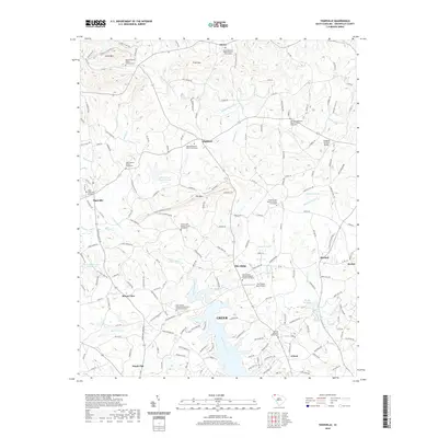
2020 Map of Tigerville
USGS Topo · Published 2020About this map
The Middle Tyger River and South Tyger River systems define the landscape of northern Greenville County in this recent survey. Significant local landmarks include North Greenville University near Tigerville and the iconic Campbell Covered Bridge spanning Beaverdam Cr in the east. The terrain transitions from the elevations of Little Mtn, Tillet Mtn, and Pax Mtn in the north toward the developing fringes of Greer in the south.
Find a feature on this map
156 named features on this map. Tap any name to fly to it.
Don’t see what you’re looking for? This feature index may not catch every label — zoom into the map to look around manually.
Map Details
Editions of this 2020 Tigerville Map
This is the sole edition of this map. No revisions or reprints were ever made.
Other maps of this area

1907 · Saluda
USGS Topo · 1:125,000

1935 · Greer
USGS Topo · 1:48,000

1935 · Greenville
USGS Topo · 1:48,000

1935 · Zirconia
USGS Topo · 1:24,000

1938 · Greenville
USGS Topo · 1:62,500

1938 · Greer
USGS Topo · 1:62,500

1946 · Zirconia
USGS Topo · 1:24,000
1947 · Zirconia
USGS Topo · 1:24,000
1954 · Zirconia
USGS Topo · 1:25,000

1954 · Greenville
USGS Topo · 1:250,000