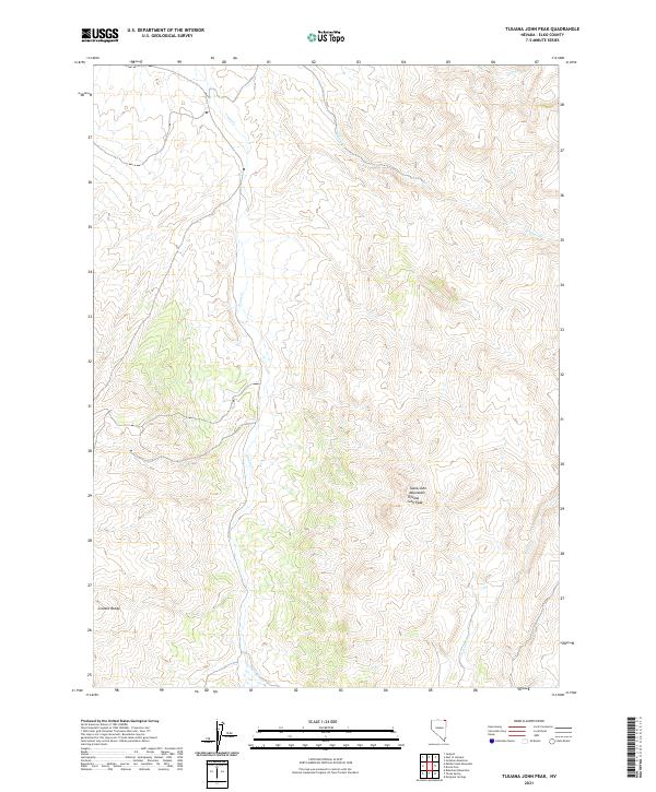
2021 Map of Tijuana John Peak
USGS Topo · Published 2021About this map
Tijuana John Peak stands as the primary landmark in this corner of the Toana John Mountains, a high desert landscape where elevations shift dramatically across the central portion of the sheet. The terrain is defined by the headwaters and drainage patterns of multiple creeks, including Trout Cr, which flows northward through the heart of the mountains, and Willow Cr to the northeast. To the southwest, the topography transitions toward the Granite Range, showing the stark intersection of multiple high-altitude formations. The map documents the Public Land Survey System grid across four townships, including t46n r65e and t45n r66e, revealing a landscape primarily structured by natural hydrology and surveyor boundaries rather than concentrated settlements. This 2021 update utilizes modern NAIP imagery and National Hydrography Dataset facts to precisely locate these permanent water features and peaks within the high Nevada desert.
Find a feature on this map
10 named features on this map. Tap any name to fly to it.
Don’t see what you’re looking for? This feature index may not catch every label — zoom into the map to look around manually.
Map Details
Editions of this 2021 Tijuana John Peak Map
This is the sole edition of this map. No revisions or reprints were ever made.
Other maps of this area

1955 · Wells
USGS Topo · 1:250,000

1957 · Delaplain
USGS Topo · 1:62,500

1958 · Wells
USGS Topo · 1:250,000

1961 · Wells
USGS Topo · 1:250,000

1961 · Delano Mountains
USGS Topo · 1:62,500

1961 · Gollaher Mountain
USGS Topo · 1:62,500

1968 · Blanchard Mtn
USGS Topo · 1:24,000

1968 · Texas Spring
USGS Topo · 1:24,000

1982 · Jackpot
USGS Topo · 1:100,000
1989 · Jackpot
USGS Topo · 1:24,000