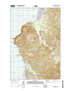
2014 Map of Tillamook Head
USGS Topo · Published 2014About this map
The Seaside shoreline and the high, forested promontory of Tillamook Head dominate this coastal survey. This landscape transition highlights the developed resort area of Seaside in the north, featuring Mantel Lake and the Chapman Ponds, against the steep ascent of Clark's Mtn and Bald Mtn. To the south, the community of Cannon Beach sits at the foot of these heights, bordered by the iconic Haystack Rock and The Needles.
Find a feature on this map
100 named features on this map. Tap any name to fly to it.
Don’t see what you’re looking for? This feature index may not catch every label — zoom into the map to look around manually.
Map Details
Editions of this 2014 Tillamook Head Map
This is the sole edition of this map. No revisions or reprints were ever made.
Other maps of this area

1919 · Astoria
USGS Topo · 1:62,500

1939 · Astoria
USGS Topo · 1:62,500

1940 · Cape Falcon
USGS Topo · 1:62,500

1943 · Copalis Beach
USGS Topo · 1:250,000

1948 · Vancouver
USGS Topo · 1:250,000

1949 · Tillamook Head
USGS Topo · 1:24,000

1949 · Gearhart
USGS Topo · 1:24,000
1949 · Olney
USGS Topo · 1:24,000

1950 · Vancouver
USGS Topo · 1:250,000

1950 · Vancouver
USGS Topo · 1:250,000