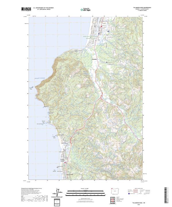
2024 Map of Tillamook Head
USGS Topo · Published 2024About this map
Seaside and Cannon Beach anchor this coastal survey, where the Pacific shoreline meets the steep, wooded rise of Tillamook Head. The landscape is a mosaic of conservation and residential development, prominently featuring the Lewis and Clark National Historical Park and the offshore sanctuary of the Oregon Islands National Wildlife Refuge. The drainage patterns of the Necanicum River and Neawanna Creek define the northern lowlands, while the southern coast is marked by iconic geological features like Haystack Rock and The Needles. Historic transportation routes are visible through segments of Old US Hwy 101, which winds through the terrain between Kramer Point and Rippet Mtn. Smaller communities such as Tolovana Park and the academic grounds of Ecola Bible College illustrate the long-standing human presence along this geologically active coastline.
Find a feature on this map
89 named features on this map. Tap any name to fly to it.
Don’t see what you’re looking for? This feature index may not catch every label — zoom into the map to look around manually.
Map Details
Editions of this 2024 Tillamook Head Map
This is the sole edition of this map. No revisions or reprints were ever made.
Other maps of this area

1919 · Astoria
USGS Topo · 1:62,500

1939 · Astoria
USGS Topo · 1:62,500

1940 · Cape Falcon
USGS Topo · 1:62,500

1943 · Copalis Beach
USGS Topo · 1:250,000

1948 · Vancouver
USGS Topo · 1:250,000

1949 · Tillamook Head
USGS Topo · 1:24,000

1949 · Gearhart
USGS Topo · 1:24,000
1949 · Olney
USGS Topo · 1:24,000

1950 · Vancouver
USGS Topo · 1:250,000

1950 · Vancouver
USGS Topo · 1:250,000