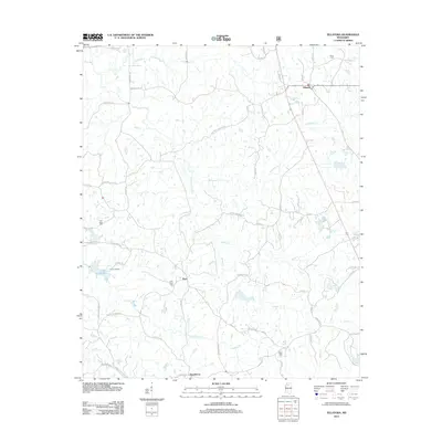
2012 Map of Tillatoba
USGS Topo · Published 2012About this map
Tillatoba anchors the northeastern corner of this Tallahatchie County landscape, where the terrain is defined by the intricate dendritic drainage systems of Tillatoba Cr and the S Fork Tillatoba. To the south, the community of Rosebloom sits near the winding course of Ascalmore Cr, a tributary that feeds into Lake Ascalmore. The map reveals a rural settlement pattern concentrated along local corridors like Cascilla Rd and Rosebloom Rd, with several community landmarks marking the passage of time. Genealogists will find interest in the scattered burial grounds that serve these small clusters, including Union Cem near the northern boundary and Saint Pauls Cem situated near the crossroads of Paul. The presence of Camp Lakeside on the shores of Lake Ascalmore suggests a long-standing local focus on the area's water resources for recreation and community gathering.
Find a feature on this map
68 named features on this map. Tap any name to fly to it.
Don’t see what you’re looking for? This feature index may not catch every label — zoom into the map to look around manually.
Map Details
Editions of this 2012 Tillatoba Map
This is the sole edition of this map. No revisions or reprints were ever made.
Other maps of this area

1932 · Philipp
USGS Topo · 1:48,000

1935 · Crowder
USGS Topo · 1:62,500

1935 · Philipp
USGS Topo · 1:62,500

1939 · Crowder
USGS Topo · 1:62,500

1939 · Philipp
USGS Topo · 1:62,500

1948 · Helena
USGS Topo · 1:250,000

1950 · Helena
USGS Topo · 1:250,000

1953 · Greenwood
USGS Topo · 1:250,000

1953 · West Point
USGS Topo · 1:250,000

1954 · Grenada
USGS Topo · 1:62,500