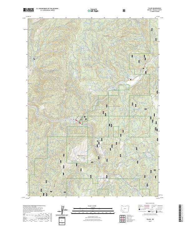
2023 Map of Tiller
USGS Topo · Published 2023About this map
Tiller stands at the confluence of the South Umpqua River and Elk Creek, serving as a central point in this part of Douglas County. The landscape is defined by the steep drainage basins of the Umpqua National Forest, where numerous creeks like Dompier Creek and Coffee Creek carve through the terrain. Evidence of local history is preserved in several small burial grounds, including Coffee Creek Cem and Rondeau Cem, which are tucked away near the heights of Rondeau Butte.
Find a feature on this map
56 named features on this map. Tap any name to fly to it.
Don’t see what you’re looking for? This feature index may not catch every label — zoom into the map to look around manually.
Map Details
Editions of this 2023 Tiller Map
This is the sole edition of this map. No revisions or reprints were ever made.
Other maps of this area

1891 · Ashland
USGS Topo · 1:250,000

1893 · Ashland
USGS Topo · 1:250,000

1897 · Roseburg
USGS Topo · 1:125,000

1897 · Ashland
USGS Topo · 1:250,000

1900 · Roseburg
USGS Topo · 1:125,000

1904 · Riddle
USGS Topo · 1:125,000

1944 · Tiller
USGS Topo · 1:62,500

1954 · Dixonville
USGS Topo · 1:62,500

1954 · Days Creek
USGS Topo · 1:62,500

1955 · Red Butte
USGS Topo · 1:62,500