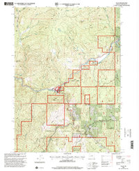
1998 Map of Tiller
USGS Topo · Published 2000About this map
Tiller sits at the confluence where the South Fork Umpqua River meets several mountain drainages, serving as a hub for both the Umpqua National Forest and local industrial operations. By the late 1990s, the landscape reflects a complex management of natural resources, indicated by the Tiller Ranger Station, a Substation, and a Heliport. The surrounding terrain is marked by significant extractive history, including the Graham Placer Mines along the western creeks and numerous quarries scattered through the high ridges.
Find a feature on this map
42 named features on this map. Tap any name to fly to it.
Don’t see what you’re looking for? This feature index may not catch every label — zoom into the map to look around manually.
Map Details
Editions of this 1998 Tiller Map
This is the sole edition of this map. No revisions or reprints were ever made.
Other maps of this area

1891 · Ashland
USGS Topo · 1:250,000

1893 · Ashland
USGS Topo · 1:250,000

1897 · Roseburg
USGS Topo · 1:125,000

1897 · Ashland
USGS Topo · 1:250,000

1900 · Roseburg
USGS Topo · 1:125,000

1904 · Riddle
USGS Topo · 1:125,000

1944 · Tiller
USGS Topo · 1:62,500

1954 · Dixonville
USGS Topo · 1:62,500

1954 · Days Creek
USGS Topo · 1:62,500

1955 · Red Butte
USGS Topo · 1:62,500