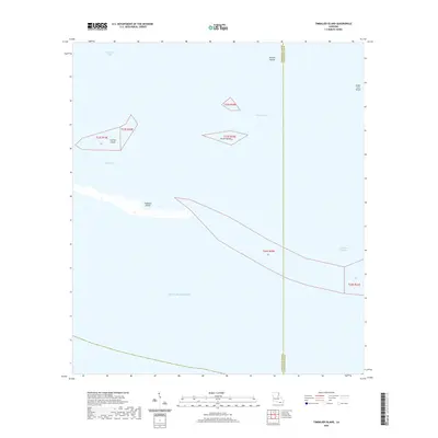
2020 Map of Timbalier Island
USGS Topo · Published 2020About this map
Timbalier Island and its surrounding barrier features mark the edge of the Louisiana coast where the marshlands meet the Gulf of Mexico. This maritime landscape is defined by its shifting sands and tidal passages, situated along the parish line between Terrebonne Parish and Lafourche Parish. The map details the separation of inner waters like Terrebonne Bay and Timbalier Bay from the open sea, protected by landforms such as Caillou Island and Brush Island. Navigational features like Caillou Pass and Little Pass Timbalier highlight the dynamic nature of these coastal inlets. In a region where the shoreline is constantly reshaped by the elements, these islands provide the primary buffer for the mainland estuaries and wetlands to the north.
Find a feature on this map
15 named features on this map. Tap any name to fly to it.
Don’t see what you’re looking for? This feature index may not catch every label — zoom into the map to look around manually.
Map Details
Editions of this 2020 Timbalier Island Map
This is the sole edition of this map. No revisions or reprints were ever made.
Other maps of this area

1894 · Timbalier
USGS Topo · 1:62,500

1935 · Timbalier Island
USGS Topo · 1:31,680

1935 · Pelican Pass
USGS Topo · 1:31,680

1935 · Calumet Island
USGS Topo · 1:31,680

1945 · Lake La Graisse
USGS Topo · 1:31,680

1945 · New Orleans
USGS Topo · 1:250,000

1946 · Lake La Graisse
USGS Topo · 1:31,680

1947 · Jacko Bay
USGS Topo · 1:31,680
1953 · Jacko Bay
USGS Topo · 1:24,000
1953 · Calumet Island
USGS Topo · 1:24,000