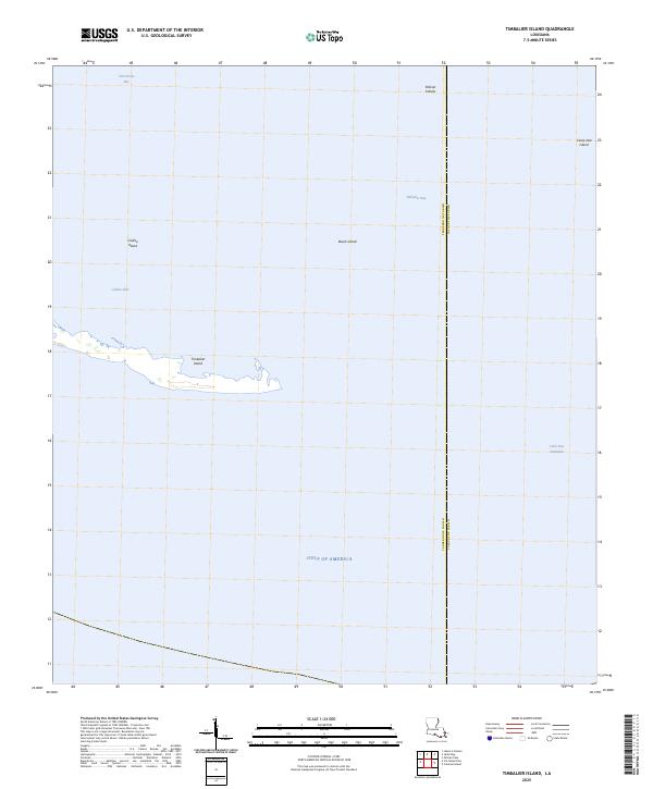
2025 Map of Timbalier Island
USGS Topo · Published 2025About this map
Timbalier Island and its surrounding archipelago define this maritime landscape along the boundary of Terrebonne Parish and Lafourche Parish. The map reveals a dynamic coastal environment where the open waters of the Gulf of America meet sheltered estuaries like Timbalier Bay and Terrebonne Bay. This 2025 survey highlights the shifting nature of these barrier landforms, including Brush Island, Caillou Island, and the scattered Pelican Islands. Navigational channels are central to the geography of this region, with Caillou Pass and Little Pass Timbalier serving as critical breaks in the barrier chain. For those studying the evolution of the Louisiana coast, the proximity of Casse-tete Island to the parish line illustrates the ongoing interplay between administrative boundaries and changing island morphology.
Find a feature on this map
11 named features on this map. Tap any name to fly to it.
Don’t see what you’re looking for? This feature index may not catch every label — zoom into the map to look around manually.
Map Details
Editions of this 2025 Timbalier Island Map
This is the sole edition of this map. No revisions or reprints were ever made.
Other maps of this area

1894 · Timbalier
USGS Topo · 1:62,500

1935 · Timbalier Island
USGS Topo · 1:31,680

1935 · Pelican Pass
USGS Topo · 1:31,680

1935 · Calumet Island
USGS Topo · 1:31,680

1945 · Lake La Graisse
USGS Topo · 1:31,680

1945 · New Orleans
USGS Topo · 1:250,000

1946 · Lake La Graisse
USGS Topo · 1:31,680

1947 · Jacko Bay
USGS Topo · 1:31,680
1953 · Jacko Bay
USGS Topo · 1:24,000
1953 · Calumet Island
USGS Topo · 1:24,000