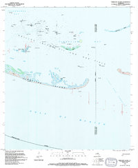
1994 Map of Timbalier Island
USGS Topo · Published 1994About this map
Caillou Island Oil and Gas Field dominates this 1994 coastal survey, illustrating the extensive industrial footprint across the barrier islands of Terrebonne Parish. The landscape is a network of Oil Platforms, Gas Platforms, and Tanks positioned throughout the shallow waters of Caillou Bay and Timbalier Bay. These structures stand in contrast to the shifting, tide-swept reaches of Timbalier Island and Brush Island, which are characterized by expansive areas of Sand and marsh.
Find a feature on this map
23 named features on this map. Tap any name to fly to it.
Don’t see what you’re looking for? This feature index may not catch every label — zoom into the map to look around manually.
Map Details
Editions of this 1994 Timbalier Island Map
This is the sole edition of this map. No revisions or reprints were ever made.
Other maps of this area

1894 · Timbalier
USGS Topo · 1:62,500

1935 · Timbalier Island
USGS Topo · 1:31,680

1935 · Pelican Pass
USGS Topo · 1:31,680

1935 · Calumet Island
USGS Topo · 1:31,680

1945 · Lake La Graisse
USGS Topo · 1:31,680

1945 · New Orleans
USGS Topo · 1:250,000

1946 · Lake La Graisse
USGS Topo · 1:31,680

1947 · Jacko Bay
USGS Topo · 1:31,680
1953 · Jacko Bay
USGS Topo · 1:24,000
1953 · Calumet Island
USGS Topo · 1:24,000