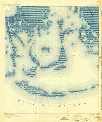
1894 Map of Timbalier
USGS Topo · Published 1926About this map
Timbalier Island and its smaller counterpart, East Timbalier Island, form a narrow barrier between the open Gulf of Mexico and the labyrinthine wetlands of southern Terrebonne Parish. Surveyed in the late 19th century, this aquatic landscape is defined by its fluid geography, where Bayou Terrebonne and Bayou Blue discharge into the expansive Timbalier Bay. The presence of Jacko Camp near Jacko Camp Bay suggests the early importance of these waters for local fishing and maritime activity.
Find a feature on this map
21 named features on this map. Tap any name to fly to it.
Don’t see what you’re looking for? This feature index may not catch every label — zoom into the map to look around manually.
Map Details
Editions of this 1894 Timbalier Map
3 editions found
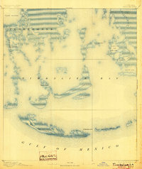
Other maps of this area

1892 · Cheniere Caminada
USGS Topo · 1:62,500

1892 · Creole
USGS Topo · 1:62,500

1894 · Timbalier
USGS Topo · 1:62,500

1894 · Lake Felicity
USGS Topo · 1:62,500

1894 · Dulac
USGS Topo · 1:62,500

1935 · Bourbeux
USGS Topo · 1:31,680

1935 · Timbalier Island
USGS Topo · 1:31,680

1935 · Bay Courant
USGS Topo · 1:31,680

1935 · Pelican Pass
USGS Topo · 1:31,680

1935 · Mink Bayou
USGS Topo · 1:31,680