
1979 Map of Timber Buttes South
USGS Topo · Published 1980About this map
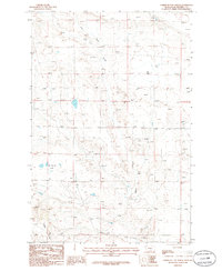
The high plains of the Musselshell and Golden Valley county line are defined by the prominent Timber Buttes and Naderman Buttes on this 1970s topographic study. The landscape is carved by a network of drainage systems, most notably Pole Creek, Cat Creek, and Cameron Creek, which cut through the arid terrain. Human activity is focused on resource extraction and utility infrastructure, evidenced by the industrial presence of a Gravel Pit and several pipelines traversing the sections. Scattered wells are marked throughout the quadrangle, reflecting the region's reliance on groundwater and potential mineral exploration. The boundary between Golden Valley Co and Musselshell Co bisects the map, providing a clear reference for researchers looking into historical property records or county development in this part of Montana.
Find a feature on this map
11 named features on this map. Tap any name to fly to it.
Don’t see what you’re looking for? This feature index may not catch every label — zoom into the map to look around manually.
Map Details
Editions of this 1979 Timber Buttes South Map
This is the sole edition of this map. No revisions or reprints were ever made.
Other maps of this area

1954 · Roundup
USGS Topo · 1:250,000

1958 · Roundup
USGS Topo · 1:250,000

1979 · Roundup
USGS Topo · 1:100,000

1979 · Bundy
USGS Topo · 1:24,000

1979 · Lavina NW
USGS Topo · 1:24,000

1979 · Lavina
USGS Topo · 1:24,000

1979 · Elso
USGS Topo · 1:24,000

1979 · Horsethief Creek
USGS Topo · 1:24,000

1986 · Emory School
USGS Topo · 1:24,000
1986 · Timber Buttes North
USGS Topo · 1:24,000