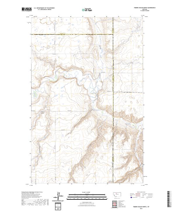
2024 Map of Timber Coulee North
USGS Topo · Published 2024About this map
The Teton River carves a deep, winding path through this portion of the Montana plains, creating a landscape defined by dramatic elevation changes and intricate drainage systems. Along its course, numerous steep-sided valleys known as coulees branch off into the surrounding benchland, including Spencer Coulee and Kinley Coulee. The topography reveals the characteristic erosional patterns of the high plains, where ephemeral streams like Flat Coulee and Rye Coulee have sculpted the earth over millennia. The road network follows the rigid Public Land Survey System grid, interrupted only by the river's rugged breaks. Local history is reflected in names such as Faris School Rd and the Copenhaver area, marking the homesteading and agricultural heritage of the region. The map also delineates the convergence of Teton, Pondera, and Chouteau counties, highlighting how the river and its terrain influenced early political and property boundaries in this rural landscape.
Find a feature on this map
27 named features on this map. Tap any name to fly to it.
Don’t see what you’re looking for? This feature index may not catch every label — zoom into the map to look around manually.
Map Details
Editions of this 2024 Timber Coulee North Map
This is the sole edition of this map. No revisions or reprints were ever made.
Other maps of this area

1886 · Great Falls
USGS Topo · 1:250,000

1920 · Conrad
USGS Topo · 1:125,000

1949 · Timber Coulee
USGS Topo · 1:62,500

1950 · Timber Coulee
USGS Topo · 1:62,500

1950 · Dutton
USGS Topo · 1:62,500

1954 · Great Falls
USGS Topo · 1:250,000

1954 · Shelby
USGS Topo · 1:250,000

1957 · Great Falls
USGS Topo · 1:250,000

1958 · Shelby
USGS Topo · 1:250,000
1965 · Sheep Coulee Spring
USGS Topo · 1:24,000