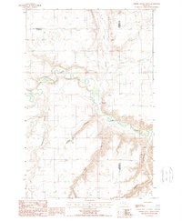
1987 Map of Timber Coulee North
USGS Topo · Published 1987About this map
The Teton River meanders across this northern Montana landscape, defining the intersection of Pondera, Chouteau, and Teton counties. The terrain is characterized by a series of significant drainage systems, including Spencer Coulee, Flat Coulee, and Kinnerly Coulee, which carve through the high plains toward the river valley. A prominent natural landmark known as the Nipple rises above the surrounding flats, providing a distinct navigational point in an area otherwise marked by industrial infrastructure.
Find a feature on this map
14 named features on this map. Tap any name to fly to it.
Don’t see what you’re looking for? This feature index may not catch every label — zoom into the map to look around manually.
Map Details
Editions of this 1987 Timber Coulee North Map
This is the sole edition of this map. No revisions or reprints were ever made.
Other maps of this area

1886 · Great Falls
USGS Topo · 1:250,000

1920 · Conrad
USGS Topo · 1:125,000

1949 · Timber Coulee
USGS Topo · 1:62,500

1950 · Timber Coulee
USGS Topo · 1:62,500

1950 · Dutton
USGS Topo · 1:62,500

1954 · Great Falls
USGS Topo · 1:250,000

1954 · Shelby
USGS Topo · 1:250,000

1957 · Great Falls
USGS Topo · 1:250,000

1958 · Shelby
USGS Topo · 1:250,000
1965 · Sheep Coulee Spring
USGS Topo · 1:24,000