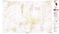
1988 Map of Timpahute Range
USGS Topo · Published 1988About this map
Pahranagat Valley serves as a critical riparian corridor in this desert landscape, where water features like Frenchy Lake and Nesbitt Lake support the Key Pittman State Wildlife Management Area. The map illustrates a stark transition between the developed valley floor near Hiko and the surrounding high-elevation terrain of the Mount Irish Range and Timpahute Range. To the west, the presence of the Nellis Air Force Range and its Restricted Access Area signals the region's mid-century military significance, while scattered mines and the Base Line survey marker indicate earlier industrial and administrative efforts to organize this corner of Lincoln County. Agricultural life is evidenced by the Cottonwood Reservoir and Murphy Gap Reservoir, which manage seasonal runoff from the Golden Gate Range for the settlements of Crystal Springs and beyond.
Find a feature on this map
39 named features on this map. Tap any name to fly to it.
Don’t see what you’re looking for? This feature index may not catch every label — zoom into the map to look around manually.
Map Details
Editions of this 1988 Timpahute Range Map
This is the sole edition of this map. No revisions or reprints were ever made.
Other maps of this area

1885 · Pioche
USGS Topo · 1:250,000

1886 · Pioche
USGS Topo · 1:250,000

1908 · Kawich
USGS Topo · 1:250,000

1942 · Emigrant Valley
USGS Topo · 1:125,000

1942 · Reveille Peak
USGS Topo · 1:125,000

1942 · Wheelbarrow Peak
USGS Topo · 1:125,000

1942 · Penoyer Valley
USGS Topo · 1:125,000

1945 · Alamo
USGS Topo · 1:125,000

1952 · White Blotch Springs
USGS Topo · 1:62,500

1952 · Reveille Peak
USGS Topo · 1:62,500