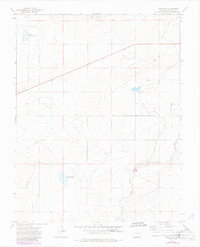
1972 Map of Timpas NE
USGS Topo · Published 1985About this map
Swink Reservoir No 1 and Prairie Land Reservoir No 1 anchor this arid Otero County landscape, illustrating the critical role of water management in Colorado's high plains during the early 1970s. The region is defined by a sophisticated network of irrigation and infrastructure, including the Highline Canal and the Rocky Ford Canal, which carve through the terrain to support local agriculture. This survey, updated with revisions from 1983, also tracks industrial and utility footprints such as a Gravel Pit, an exploratory Drill Hole, and a prominent Pipeline traversing the quadrangle. The presence of a Flowing Well and various fence lines, marked in fine red dashed lines, provides specific detail for those researching historical land use or surveying the rural development of the Arkansas River Valley's outskirts.
Find a feature on this map
12 named features on this map. Tap any name to fly to it.
Don’t see what you’re looking for? This feature index may not catch every label — zoom into the map to look around manually.
Map Details
Editions of this 1972 Timpas NE Map
3 editions found
Other maps of this area

1891 · Catlin
USGS Topo · 1:125,000

1891 · Timpas
USGS Topo · 1:125,000

1893 · Catlin
USGS Topo · 1:125,000

1894 · Timpas
USGS Topo · 1:125,000

1954 · Elder
USGS Topo · 1:24,000

1954 · Manzanola
USGS Topo · 1:24,000

1954 · Lamar
USGS Topo · 1:250,000

1955 · Rocky Ford
USGS Topo · 1:24,000

1955 · La Junta
USGS Topo · 1:250,000

1958 · La Junta
USGS Topo · 1:250,000