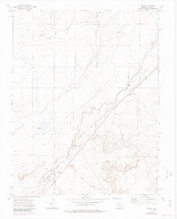
1972 Map of Timpas
USGS Topo · Published 1985About this map
The settlement of Timpas serves as a focal point for this Otero County landscape, where the iron rails of the Atchison Topeka and Santa Fe railroad parallel the path of the legendary Santa Fe Trail. This corridor represents a critical historical transportation artery, marked by a Historical Marker that notes the area's legacy as a waystation for travelers. The terrain is defined by a network of drainage systems, including Timpas Creek and its many tributaries like South Dry Creek and Lone Tree Arroyo, which feed into the ranching economy evidenced by scattered Well sites and the Brown Reservoir. To the south, the small siding of Ayer sits along the rail line near Rock Arroyo, illustrating the sparse but vital infrastructure of the high plains. Features like a small Cem and various Gravel Pit locations reflect the local community and industry that sustained this high-desert environment during the late twentieth century.
Find a feature on this map
21 named features on this map. Tap any name to fly to it.
Don’t see what you’re looking for? This feature index may not catch every label — zoom into the map to look around manually.
Map Details
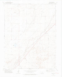
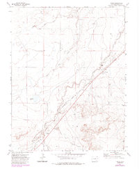
Editions of this 1972 Timpas Map
3 editions found
Other maps of this area

1891 · Timpas
USGS Topo · 1:125,000

1894 · Timpas
USGS Topo · 1:125,000

1955 · La Junta
USGS Topo · 1:250,000

1958 · La Junta
USGS Topo · 1:250,000

1965 · La Junta SW
USGS Topo · 1:24,000
1966 · Hawley
USGS Topo · 1:24,000

1968 · La Junta
USGS Topo · 1:250,000
1972 · Timpas NE
USGS Topo · 1:24,000

1972 · Packers Gap
USGS Topo · 1:24,000
1972 · Timpas SW
USGS Topo · 1:24,000