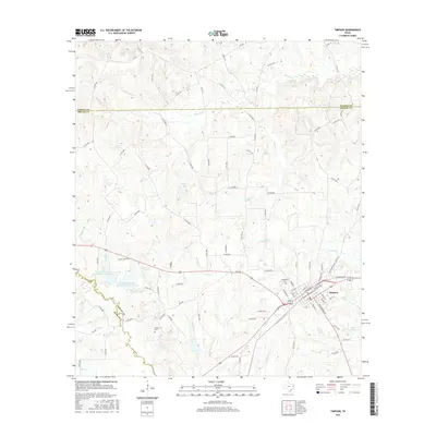
2016 Map of Timpson
USGS Topo · Published 2016About this map
Timpson serves as the primary hub of this East Texas landscape, where the confluence of several major roadways and local routes defines the town's structure. The town site is bounded by a network of drainage systems, including Flat Fork Cr to the east and Hardage Cr to the west. Evidence of local history and family lineages can be traced through sites like Woodlawn Cem near the town center and Dixon Cem to the southwest.
Find a feature on this map
94 named features on this map. Tap any name to fly to it.
Don’t see what you’re looking for? This feature index may not catch every label — zoom into the map to look around manually.
Map Details
Editions of this 2016 Timpson Map
This is the sole edition of this map. No revisions or reprints were ever made.
Other maps of this area
1953 · Palestine
USGS Topo · 1:250,000
1956 · Tyler
USGS Topo · 1:250,000
1957 · Palestine
USGS Topo · 1:250,000
1958 · Timpson
USGS Topo · 1:62,500
1958 · Carthage
USGS Topo · 1:62,500
1960 · Minden
USGS Topo · 1:62,500
1960 · Mount Enterprise
USGS Topo · 1:62,500
1983 · Long Branch
USGS Topo · 1:24,000
1983 · Gary
USGS Topo · 1:24,000
1983 · Lake Murvaul
USGS Topo · 1:24,000