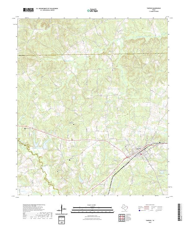
2022 Map of Timpson
USGS Topo · Published 2022About this map
The town of Timpson serves as the focal point of this East Texas survey, situated along the border of Panola and Shelby Counties. The landscape is defined by the drainage systems of Flat Fork Creek and Hardage Creek, which feed into the Attoyac River along the southwestern boundary. This modern record details a rural environment where agricultural land and dense creek bottoms are punctuated by man-made features like the Soil Conservation Service Site 7 Reservoir.
Find a feature on this map
101 named features on this map. Tap any name to fly to it.
Don’t see what you’re looking for? This feature index may not catch every label — zoom into the map to look around manually.
Map Details
Editions of this 2022 Timpson Map
This is the sole edition of this map. No revisions or reprints were ever made.
Other maps of this area

1953 · Palestine
USGS Topo · 1:250,000

1956 · Tyler
USGS Topo · 1:250,000

1957 · Palestine
USGS Topo · 1:250,000

1958 · Timpson
USGS Topo · 1:62,500

1958 · Carthage
USGS Topo · 1:62,500

1960 · Minden
USGS Topo · 1:62,500

1960 · Mount Enterprise
USGS Topo · 1:62,500

1983 · Long Branch
USGS Topo · 1:24,000
1983 · Gary
USGS Topo · 1:24,000
1983 · Lake Murvaul
USGS Topo · 1:24,000