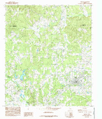
1984 Map of Timpson
USGS Topo · Published 1985About this map
Timpson serves as the primary hub of this East Texas survey, where the concentrated street grid and public infrastructure such as Athletic Fields and a Radio Tower stand in contrast to the surrounding forested bottomlands. The landscape is defined by an intricate network of waterways, most notably the Attoyac River, which forms part of the western boundary. Numerous tributaries including Flat Fork Creek, Byfield Creek, and Ship Creek carve through the terrain, illustrating the drainage patterns of the region before significant modern development. Cultural markers like a scattered Cem and a Gravel Pit indicate the local reliance on land-based industry and long-standing community roots. The map also delineates the convergence of several county lines, including the borders between Shelby, Panola, and Rusk counties, making it a valuable resource for understanding jurisdictional boundaries during the mid-1980s.
Find a feature on this map
19 named features on this map. Tap any name to fly to it.
Don’t see what you’re looking for? This feature index may not catch every label — zoom into the map to look around manually.
Map Details
Editions of this 1984 Timpson Map
This is the sole edition of this map. No revisions or reprints were ever made.
Other maps of this area

1953 · Palestine
USGS Topo · 1:250,000

1956 · Tyler
USGS Topo · 1:250,000

1957 · Palestine
USGS Topo · 1:250,000

1958 · Timpson
USGS Topo · 1:62,500

1958 · Carthage
USGS Topo · 1:62,500

1960 · Minden
USGS Topo · 1:62,500

1960 · Mount Enterprise
USGS Topo · 1:62,500

1983 · Long Branch
USGS Topo · 1:24,000
1983 · Gary
USGS Topo · 1:24,000
1983 · Lake Murvaul
USGS Topo · 1:24,000