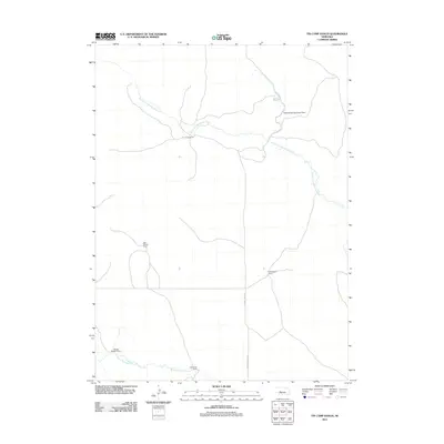
2011 Map of Tin Camp Ranch
USGS Topo · Published 2011About this map
North Fork Birdwood Creek and West Birdwood Creek carve through this section of Lincoln County, defining a landscape dominated by large-scale cattle ranching operations. The map identifies several significant homesteads and holdings, including Tin Camp Ranch, Gale Morgan Ranch, and Richardson Ranch, illustrating the dispersed settlement pattern typical of the Nebraska Sandhills. These ranches are connected by a sparse network of roads, most notably Prairie Trace Rd, which serves as a primary north-south artery through the region.
Find a feature on this map
11 named features on this map. Tap any name to fly to it.
Don’t see what you’re looking for? This feature index may not catch every label — zoom into the map to look around manually.
Map Details
Editions of this 2011 Tin Camp Ranch Map
This is the sole edition of this map. No revisions or reprints were ever made.
Other maps of this area

1898 · Paxton
USGS Topo · 1:125,000

1901 · Paxton
USGS Topo · 1:125,000

1949 · Flats
USGS Topo · 1:62,500

1949 · Wright Valley
USGS Topo · 1:62,500

1950 · Flats
USGS Topo · 1:62,500

1951 · Wright Valley
USGS Topo · 1:62,500

1954 · North Platte
USGS Topo · 1:250,000

1956 · North Platte
USGS Topo · 1:250,000

1957 · North Platte
USGS Topo · 1:250,000

1967 · North Platte
USGS Topo · 1:250,000