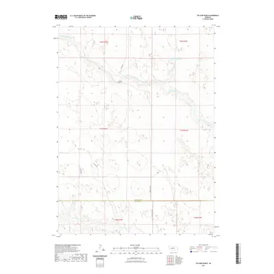
2021 Map of Tin Camp Ranch
USGS Topo · Published 2021About this map
Tin Camp Ranch occupies a central position in this Sandhills landscape, where the drainage systems of the Platte River basin begin to take shape. The terrain is defined by the winding course of the N Fork Birdwood Cr and Squaw Cr, which carve through the undulating topography of northern Lincoln County. This 2021 survey illustrates the modern ranching infrastructure of the region, anchored by the Pawnee Springs Ranch Reservoir and a network of remote access routes including Tin Camp Rd and Prairie Trace Rd. The boundary between McPherson and Lincoln Counties cuts across the southern portion of the map, marking a transition in local jurisdiction. Significant for its detail on water resources in an arid environment, the map also tracks the W Birdwood Cr as it traverses the southwestern section of the quadrangle.
Find a feature on this map
18 named features on this map. Tap any name to fly to it.
Don’t see what you’re looking for? This feature index may not catch every label — zoom into the map to look around manually.
Map Details
Editions of this 2021 Tin Camp Ranch Map
This is the sole edition of this map. No revisions or reprints were ever made.
Other maps of this area

1898 · Paxton
USGS Topo · 1:125,000

1901 · Paxton
USGS Topo · 1:125,000

1949 · Flats
USGS Topo · 1:62,500

1949 · Wright Valley
USGS Topo · 1:62,500

1950 · Flats
USGS Topo · 1:62,500

1951 · Wright Valley
USGS Topo · 1:62,500

1954 · North Platte
USGS Topo · 1:250,000

1956 · North Platte
USGS Topo · 1:250,000

1957 · North Platte
USGS Topo · 1:250,000

1967 · North Platte
USGS Topo · 1:250,000