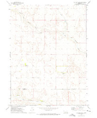
1972 Map of Tin Camp Ranch
USGS Topo · Published 1975About this map
Isolated cattle ranches define this portion of the Nebraska Sandhills during the early 1970s, where family operations like the Gale Morgan Ranch and Richardson Ranch are positioned near vital water sources. The landscape is dominated by the intricate drainage systems of the North Fork Birdwood Creek and West Birdwood Creek, which provide the necessary irrigation for this pastoral environment. Along the McPherson Co Lincoln Co boundary, the map documents specific infrastructure essential to high-plains agriculture, including a Flowing Well and the Harshfield Ranch. The distribution of these named homesteads, such as the Tin Camp Ranch and Charles Morgan Ranch, illustrates a sparse settlement pattern where survival depended on securing reliable access to the creeks and wells carved into the rolling terrain.
Find a feature on this map
11 named features on this map. Tap any name to fly to it.
Don’t see what you’re looking for? This feature index may not catch every label — zoom into the map to look around manually.
Map Details
Editions of this 1972 Tin Camp Ranch Map
This is the sole edition of this map. No revisions or reprints were ever made.
Other maps of this area

1898 · Paxton
USGS Topo · 1:125,000

1901 · Paxton
USGS Topo · 1:125,000

1949 · Flats
USGS Topo · 1:62,500

1949 · Wright Valley
USGS Topo · 1:62,500

1950 · Flats
USGS Topo · 1:62,500

1951 · Wright Valley
USGS Topo · 1:62,500

1954 · North Platte
USGS Topo · 1:250,000

1956 · North Platte
USGS Topo · 1:250,000

1957 · North Platte
USGS Topo · 1:250,000

1967 · North Platte
USGS Topo · 1:250,000