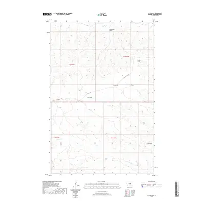
2020 Map of Tin Can Hill
USGS Topo · Published 2020About this map
Tin Can Hill rises as a prominent landmark in this section of Petroleum County, where the high plains are deeply incised by a network of drainage features known as coulees. This 2020 map documents a landscape defined by ranching and traditional land use, where local names like Camelbratten Coulee and Raundal Coulee suggest the early homesteading history of the region. The drainage systems of Blood Cr in the north and Cottonwood Cr in the south dictate the local topography, while the presence of Kettle Spring indicates the critical importance of water sources in this arid environment. Transportation is limited to rugged routes such as Lower Tin Can Hill Rd and Tincan Hill Rd, which provide access through the complex terrain of Haley Coulee and Bissett Coulee.
Find a feature on this map
16 named features on this map. Tap any name to fly to it.
Don’t see what you’re looking for? This feature index may not catch every label — zoom into the map to look around manually.
Map Details
Editions of this 2020 Tin Can Hill Map
This is the sole edition of this map. No revisions or reprints were ever made.
Other maps of this area

1954 · Jordan
USGS Topo · 1:250,000

1954 · Lewistown
USGS Topo · 1:250,000

1956 · Jordan
USGS Topo · 1:250,000

1958 · Jordan
USGS Topo · 1:250,000

1959 · Lewistown
USGS Topo · 1:250,000

1964 · Jordan
USGS Topo · 1:250,000

1967 · Nelson Coulee
USGS Topo · 1:24,000
1967 · Fail Ranch
USGS Topo · 1:24,000
1967 · Bridge Coulee
USGS Topo · 1:24,000
1985 · Kirkendal Flat
USGS Topo · 1:24,000