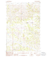
1986 Map of Tin Can Hill
USGS Topo · Published 1986About this map
Tin Can Hill stands as the central landmark in this 1986 survey of central Montana, a landscape defined by an intricate network of drainage channels and named coulees. The map illustrates a classic High Plains topography where ephemeral waterways like Blood Creek and Cottonwood Creek have carved deep incisions into the terrain. The inclusion of Kettle Spring suggests a critical water source in this semi-arid region, while the presence of several family-named or descriptive features like Camelbratten Coulee and Biggett Coulee provides localized geographical markers for researchers. This provisional edition, based on field checks from the late 1970s, captures the cattle-country character of the area through its emphasis on these remote landforms and the trails winding between Haley Coulee and Jackson Coulee.
Find a feature on this map
9 named features on this map. Tap any name to fly to it.
Don’t see what you’re looking for? This feature index may not catch every label — zoom into the map to look around manually.
Map Details
Editions of this 1986 Tin Can Hill Map
This is the sole edition of this map. No revisions or reprints were ever made.
Other maps of this area

1954 · Jordan
USGS Topo · 1:250,000

1954 · Lewistown
USGS Topo · 1:250,000

1956 · Jordan
USGS Topo · 1:250,000

1958 · Jordan
USGS Topo · 1:250,000

1959 · Lewistown
USGS Topo · 1:250,000

1964 · Jordan
USGS Topo · 1:250,000

1967 · Nelson Coulee
USGS Topo · 1:24,000
1967 · Fail Ranch
USGS Topo · 1:24,000
1967 · Bridge Coulee
USGS Topo · 1:24,000
1985 · Kirkendal Flat
USGS Topo · 1:24,000