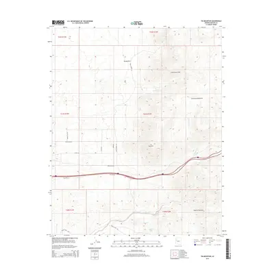
2014 Map of Tin Mountain
USGS Topo · Published 2014About this map
Tin Mountain and the high desert terrain of the Cottonwood Mountains dominate this Mohave County landscape, where elevation changes dramatically across the Cottonwood Cliffs. The 2014 survey documents a network of rural ranch roads, including Tammany Hill Rd and Randy Ranch Rd, which navigate the foothills and alluvial fans. Water sources are vital but sparse in this arid environment, marked by sites like Faculty Springs and Mesquite Thicket Spring. To the south, the terrain descends toward the drainage of Knight Creek, which is paralleled by Knight Creek Rd. The presence of the Aquarius Mountains in the southeast corner further illustrates the complex geology of this portion of Arizona, where seasonal waterways like Willow Cr and Cottonwood Cr have carved distinct paths through the high plateaus.
Find a feature on this map
27 named features on this map. Tap any name to fly to it.
Don’t see what you’re looking for? This feature index may not catch every label — zoom into the map to look around manually.
Map Details
Editions of this 2014 Tin Mountain Map
This is the sole edition of this map. No revisions or reprints were ever made.
Other maps of this area
1886 · Diamond Creek
USGS Topo · 1:250,000
1892 · Diamond Creek
USGS Topo · 1:250,000
1948 · Williams
USGS Topo · 1:250,000
1954 · Williams
USGS Topo · 1:250,000
1956 · Williams
USGS Topo · 1:250,000
1960 · Williams
USGS Topo · 1:250,000
1961 · Williams
USGS Topo · 1:250,000
1968 · Austin Peak
USGS Topo · 1:24,000
1968 · Hackberry
USGS Topo · 1:24,000
1968 · Bottleneck Wash
USGS Topo · 1:24,000