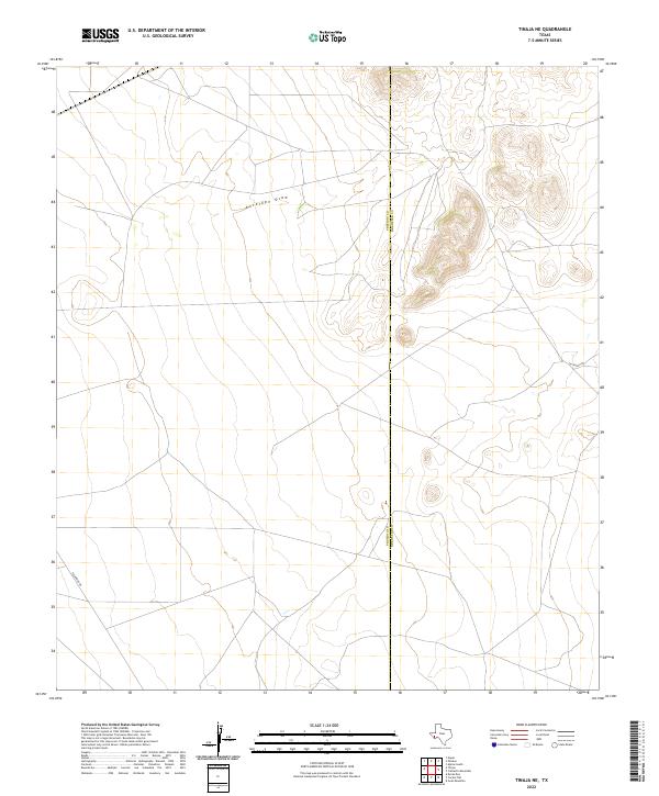
2022 Map of Tinaja NE
USGS Topo · Published 2022About this map
Antelope Draw carves a path through the high desert of the Big Bend region, serving as the primary drainage for this segment of the Trans-Pecos landscape. The map captures a transitional zone where the county line between Presidio County and Brewster County runs north to south, bisecting a series of elevated ridges and peaks. Modern access to this sparsely populated rangeland is limited to a handful of unpaved corridors, most notably Escondido Rd and 101 Ranch Rd. The absence of named settlements or civic structures highlights the vast, open character of these private ranchlands, where topographic variations and dry watercourses dictate the layout of roads and property divisions in the high desert of West Texas.
Find a feature on this map
4 named features on this map. Tap any name to fly to it.
Don’t see what you’re looking for? This feature index may not catch every label — zoom into the map to look around manually.
Map Details
Editions of this 2022 Tinaja NE Map
This is the sole edition of this map. No revisions or reprints were ever made.
Other maps of this area

1895 · Alpine
USGS Topo · 1:125,000

1954 · Fort Stockton
USGS Topo · 1:250,000

1958 · Fort Stockton
USGS Topo · 1:250,000

1972 · Paisano
USGS Topo · 1:24,000

1972 · Nopal
USGS Topo · 1:24,000

1972 · Alpine South
USGS Topo · 1:24,000

1973 · Fort Stockton
USGS Topo · 1:250,000
1983 · Cactus Flat
USGS Topo · 1:24,000
1983 · Goat Mountain
USGS Topo · 1:24,000
1983 · Tinaja NE
USGS Topo · 1:24,000