
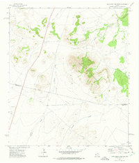
1972 Map of Nopal
USGS Topo · Published 1975About this map
Southern Pacific rails cut a straight path across this high desert landscape of Presidio County, anchoring the small settlement at Nopal and the nearby Nopal Ranch. The terrain is defined by a complex network of ephemeral watercourses including Cuervo Draw, Colquitt Draw, and Long Draw, which drain toward the south and east. These drainages, along with man-made features like Catto Tank and W-Bar Tank, illustrate the vital importance of water management in this arid cattle-ranching country during the early 1970s.
Find a feature on this map
20 named features on this map. Tap any name to fly to it.
Don’t see what you’re looking for? This feature index may not catch every label — zoom into the map to look around manually.
Map Details
Editions of this 1972 Nopal Map
This is the sole edition of this map. No revisions or reprints were ever made.
Other maps of this area

1895 · Marfa
USGS Topo · 1:125,000

1895 · Alpine
USGS Topo · 1:125,000

1954 · Fort Stockton
USGS Topo · 1:250,000

1958 · Fort Stockton
USGS Topo · 1:250,000

1959 · Marfa
USGS Topo · 1:250,000

1965 · Marfa
USGS Topo · 1:250,000

1972 · Paisano
USGS Topo · 1:24,000

1972 · Mitre Peak
USGS Topo · 1:24,000
1972 · Mano Prieto Mountain
USGS Topo · 1:24,000

1973 · Fort Stockton
USGS Topo · 1:250,000