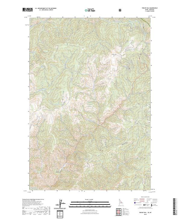
2024 Map of Tincup Hill
USGS Topo · Published 2024About this map
Tincup Hill and its surrounding drainages characterize this high-elevation landscape within the Salmon National Forest. The map detail follows the divide between the Frank Church-River of No Return Wilderness to the northwest and the extensive ridge systems of the Lemhi County backcountry. Notable topographic landmarks include Oreana Ridge, Long Tom Ridge, and Beartrap Ridge, which define the watersheds of Sourdough Creek and Owl Creek. Remote water sources such as Dishpan Spring, Beartrap Spring, and Oreana Spring are identified throughout the terrain. While mostly wilderness, the presence of historical tracks like the Mine Rd Off 123 and Mining Loop Off 123 points to a legacy of resource extraction in these remote mountains. Modern recreation is represented by the Owl Creek Trl and East Owl Creek Trl, which navigate the steep descent into Willow Meadow and the surrounding basins.
Find a feature on this map
37 named features on this map. Tap any name to fly to it.
Don’t see what you’re looking for? This feature index may not catch every label — zoom into the map to look around manually.
Map Details
Editions of this 2024 Tincup Hill Map
This is the sole edition of this map. No revisions or reprints were ever made.
Other maps of this area

1956 · Elk City
USGS Topo · 1:250,000

1960 · Elk City
USGS Topo · 1:250,000

1960 · Painted Rocks Lake
USGS Topo · 1:62,500

1960 · Shoup
USGS Topo · 1:62,500

1962 · Blue Joint
USGS Topo · 1:24,000

1962 · Long Tom Mtn
USGS Topo · 1:24,000

1962 · Horse Creek Butte
USGS Topo · 1:24,000

1982 · Bighorn Crags
USGS Topo · 1:100,000

1991 · Horse Creek Pass
USGS Topo · 1:24,000
1991 · Tincup Hill
USGS Topo · 1:24,000