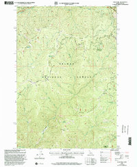
1998 Map of Tincup Hill
USGS Topo · Published 2002About this map
The Salmon National Forest dominates this mountain landscape along the Idaho Montana state line, as documented in this late-1990s survey. The terrain is characterized by high, parallel landforms including Oreana Ridge and Beartrap Ridge, which descend into drainage basins for Horse Creek and Owl Creek. High-elevation observation points at Oreana Lookout and Beartrap Lookout provide a sense of the forest management infrastructure of the era. Mineral exploration is evidenced by numerous prospect markings and established sites such as the St Clair Mine and the Nabob Mine near the southern boundary. Remote water sources like Telephone Pole Spring and Dishpan Spring served travelers on the network of 4wd tracks that cross the Frank Church - River of No Return Wilderness boundary.
Find a feature on this map
35 named features on this map. Tap any name to fly to it.
Don’t see what you’re looking for? This feature index may not catch every label — zoom into the map to look around manually.
Map Details
Editions of this 1998 Tincup Hill Map
This is the sole edition of this map. No revisions or reprints were ever made.
Other maps of this area

1956 · Elk City
USGS Topo · 1:250,000

1960 · Elk City
USGS Topo · 1:250,000

1960 · Painted Rocks Lake
USGS Topo · 1:62,500

1960 · Shoup
USGS Topo · 1:62,500

1962 · Blue Joint
USGS Topo · 1:24,000

1962 · Long Tom Mtn
USGS Topo · 1:24,000

1962 · Horse Creek Butte
USGS Topo · 1:24,000

1982 · Bighorn Crags
USGS Topo · 1:100,000

1991 · Horse Creek Pass
USGS Topo · 1:24,000
1991 · Tincup Hill
USGS Topo · 1:24,000