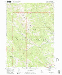
1966 Map of Tincup Mtn
USGS Topo · Published 1982About this map
Old Baldy Peak and Bald Mountain dominate the northern terrain of this 1966 survey, which documents a landscape defined by seasonal industry and traditional mountain travel within the Caribou National Forest. The presence of the Squaw Creek Sawmill (Site) near Squaw Creek points to historical timber extraction in the region, while the extensive network of pack routes, including the Bald Mountain Pack Trail and Hubler Trail, indicates how these peaks were accessed before modern road development. The map covers the boundary between Bonneville and Caribou counties, following a complex drainage system where Jackknife Creek and Tincup Creek carve through the high elevations of Tincup Mtn and Black Mountain. Local history researchers can trace family-named features like Luthi Canyon, Haderlie Creek, and Marshall Canyon, which mark the lower reaches of the watershed.
Find a feature on this map
24 named features on this map. Tap any name to fly to it.
Don’t see what you’re looking for? This feature index may not catch every label — zoom into the map to look around manually.
Map Details
Editions of this 1966 Tincup Mtn Map
4 editions found
Other maps of this area

1915 · Freedom
USGS Topo · 1:62,500

1915 · Lanes Creek
USGS Topo · 1:62,500

1932 · Irwin
USGS Topo · 1:96,000

1935 · Irwin
USGS Topo · 1:125,000

1955 · Driggs
USGS Topo · 1:250,000

1955 · Preston
USGS Topo · 1:250,000

1958 · Driggs
USGS Topo · 1:250,000

1958 · Preston
USGS Topo · 1:250,000

1962 · Driggs
USGS Topo · 1:250,000

1962 · Preston
USGS Topo · 1:250,000