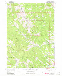
1966 Map of Tincup Mtn
USGS Topo · Published 1982About this map
Caribou National Forest dominates this mid-1960s terrain, where the high ridges of Bald Mountain and Tincup Mtn define a landscape of deep canyons and seasonal watersheds. The map details a network of drainage systems including Jackknife Creek, Taylor Creek, and the various forks of Fish Creek. A notable point of human activity is the Squaw Creek Sawmill (Site) located in the eastern portion of the quadrangle, indicating the historic importance of the timber industry in this part of Idaho.
Find a feature on this map
28 named features on this map. Tap any name to fly to it.
Don’t see what you’re looking for? This feature index may not catch every label — zoom into the map to look around manually.
Map Details
Editions of this 1966 Tincup Mtn Map
4 editions found
Other maps of this area

1915 · Freedom
USGS Topo · 1:62,500

1915 · Lanes Creek
USGS Topo · 1:62,500

1932 · Irwin
USGS Topo · 1:96,000

1935 · Irwin
USGS Topo · 1:125,000

1955 · Driggs
USGS Topo · 1:250,000

1955 · Preston
USGS Topo · 1:250,000

1958 · Driggs
USGS Topo · 1:250,000

1958 · Preston
USGS Topo · 1:250,000

1962 · Driggs
USGS Topo · 1:250,000

1962 · Preston
USGS Topo · 1:250,000