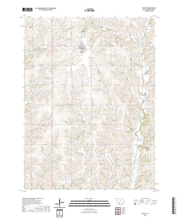
2023 Map of Tingley
USGS Topo · Published 2023About this map
Tingley serves as the primary hub of this southwestern Iowa landscape, situated at the intersection of a grid-like road network and agricultural lands. The town's local history is anchored by the Tingley Cem and the central Po, while the smaller settlement of Eugene appears in the northwest corner. The topography is defined by the drainage of the East Fork Grand River, which is fed by numerous tributaries including Sun Valley Creek, Gooseberry Creek, and Hackberry Creek. These waterways create a undulating terrain of ridges and valleys that dictate the placement of rural homesteads and local roads like Co RD j20 and Us HWY 169. Genealogists will find interest in the scattered rural burial sites, such as the Johnston Cem, located along the winding path of the Grand River's eastern banks.
Find a feature on this map
36 named features on this map. Tap any name to fly to it.
Don’t see what you’re looking for? This feature index may not catch every label — zoom into the map to look around manually.
Map Details
Editions of this 2023 Tingley Map
This is the sole edition of this map. No revisions or reprints were ever made.
Other maps of this area

1940 · Blockton
USGS Topo · 1:62,500

1943 · Blockton
USGS Topo · 1:62,500

1945 · Mount Ayr
USGS Topo · 1:62,500

1947 · Mount Ayr
USGS Topo · 1:62,500

1955 · Nebraska City
USGS Topo · 1:250,000

1957 · Nebraska City
USGS Topo · 1:250,000

1958 · Nebraska City
USGS Topo · 1:250,000
1981 · Arispe
USGS Topo · 1:24,000
1981 · Shannon City
USGS Topo · 1:24,000
1981 · Tingley NE
USGS Topo · 1:24,000