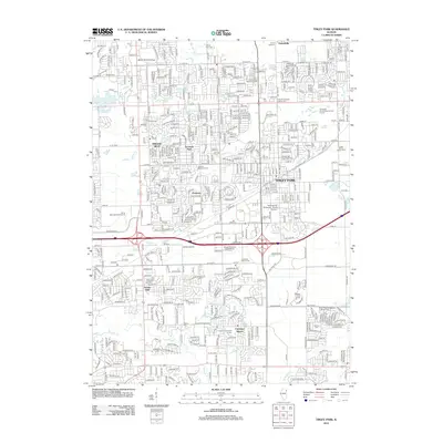
2012 Map of Tinley Park
USGS Topo · Published 2012About this map
Tinley Park and Orland Hills anchor this 2012 survey, revealing the dense suburban expansion of Cook County in the early 21st century. The landscape is defined by its extensive leisure and conservation areas, from the Saint Mihiel Reservation in the northeast to the sprawling fairways of the George W Dunne National Golf Course. Local history and genealogy are preserved in numerous denominational burial grounds, including the Old German Methodist Cem and Saint Pauls Evangelical Lutheran Cem.
Find a feature on this map
45 named features on this map. Tap any name to fly to it.
Don’t see what you’re looking for? This feature index may not catch every label — zoom into the map to look around manually.
Map Details
Editions of this 2012 Tinley Park Map
This is the sole edition of this map. No revisions or reprints were ever made.
Other maps of this area

1890 · Des Plaines
USGS Topo · 1:62,500

1892 · Calumet
USGS Topo · 1:62,500

1893 · Calumet
USGS Topo · 1:62,500

1894 · Des Plaines
USGS Topo · 1:62,500

1900 · Des Plaines
USGS Topo · 1:62,500

1900 · Calumet
USGS Topo · 1:62,500

1901 · Calumet
USGS Topo · 1:62,500

1901 · Des Plaines
USGS Topo · 1:62,500

1928 · Palos Park
USGS Topo · 1:24,000

1928 · Sag Bridge
USGS Topo · 1:24,000