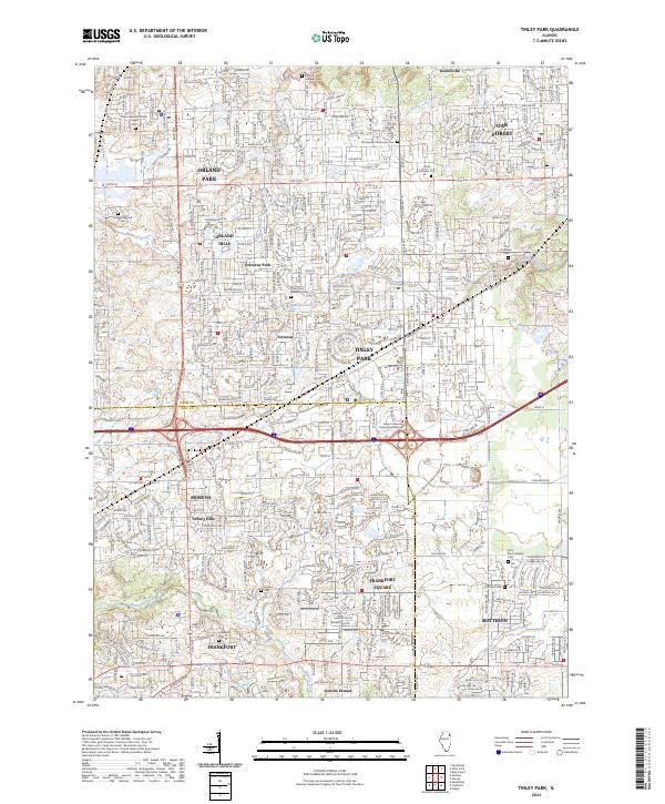
2024 Map of Tinley Park
USGS Topo · Published 2024About this map
Tinley Park and its surrounding suburbs occupy a landscape defined by an extensive grid of major thoroughfares and historic burial grounds. The transition between Cook and Will counties is clearly visible, with newer developments like Arbury Hills and Frankfort Square filling in the gaps between older established centers. Local history is deeply etched into the geography through numerous denominational resting places, including Christ Lutheran Cem, German Methodist Cem, and Saint Paul Lutheran Cem.
Find a feature on this map
56 named features on this map. Tap any name to fly to it.
Don’t see what you’re looking for? This feature index may not catch every label — zoom into the map to look around manually.
Map Details
Editions of this 2024 Tinley Park Map
This is the sole edition of this map. No revisions or reprints were ever made.
Other maps of this area

1890 · Des Plaines
USGS Topo · 1:62,500

1892 · Calumet
USGS Topo · 1:62,500

1893 · Calumet
USGS Topo · 1:62,500

1894 · Des Plaines
USGS Topo · 1:62,500

1900 · Des Plaines
USGS Topo · 1:62,500

1900 · Calumet
USGS Topo · 1:62,500

1901 · Calumet
USGS Topo · 1:62,500

1901 · Des Plaines
USGS Topo · 1:62,500

1928 · Palos Park
USGS Topo · 1:24,000

1928 · Sag Bridge
USGS Topo · 1:24,000