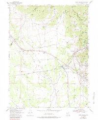
1954 Map of Tintic Junction
USGS Topo · Published 1984About this map
The East Tintic Mountains dominate this 1950s landscape, where intense industrial activity defines the terrain from Boulter Summit down through the Flat Wing Valley. The eastern half of the map is a dense network of mining operations, including the Swansea Mine, Victoria Northwest Mine, and Dagmar Mine, all tied together by the Union Pacific and various segments of old railroad grade.
Find a feature on this map
84 named features on this map. Tap any name to fly to it.
Don’t see what you’re looking for? This feature index may not catch every label — zoom into the map to look around manually.
Map Details
Editions of this 1954 Tintic Junction Map
3 editions found

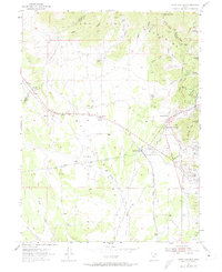
Other maps of this area

1885 · Sevier Desert
USGS Topo · 1:250,000

1885 · Tooele Valley
USGS Topo · 1:250,000

1947 · Fivemile Pass
USGS Topo · 1:62,500

1947 · Allens Ranch
USGS Topo · 1:24,000

1947 · Boulter Peak
USGS Topo · 1:24,000

1949 · Eureka
USGS Topo · 1:24,000

1949 · Allens Ranch
USGS Topo · 1:24,000

1953 · Tooele
USGS Topo · 1:250,000

1953 · Delta
USGS Topo · 1:250,000

1954 · Mc Intyre
USGS Topo · 1:24,000