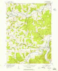
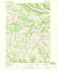
1954 Map of Tioga
USGS Topo · Published 1956About this map
Cowanesque River and the Tioga River converge near the New York Pennsylvania border, shaping the mid-century valley landscape of Tioga County. The map documents a period of active rail infrastructure, where the New York Central Line follows the riverbanks to serve riverside communities like Nelson and Lawrenceville. Small pockets of early industry are visible through infrastructure such as the Palmer Pumping Sta and a Radio Tower perched near Baldwin.
Find a feature on this map
40 named features on this map. Tap any name to fly to it.
Don’t see what you’re looking for? This feature index may not catch every label — zoom into the map to look around manually.
Map Details
Editions of this 1954 Tioga Map
4 editions found
Other maps of this area

1900 · Tioga
USGS Topo · 1:62,500

1900 · Elkland
USGS Topo · 1:62,500

1902 · Tioga
USGS Topo · 1:62,500

1914 · Corning
USGS Topo · 1:62,500

1924 · Woodhull
USGS Topo · 1:48,000

1926 · Woodhull
USGS Topo · 1:62,500

1944 · Woodhull
USGS Topo · 1:62,500

1944 · Corning
USGS Topo · 1:62,500

1950 · Elmira
USGS Topo · 1:250,000
1953 · Borden
USGS Topo · 1:24,000