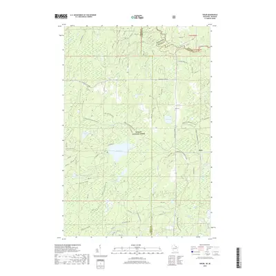
2018 Map of Tipler
USGS Topo · Published 2018About this map
The settlement of Tipler serves as the primary hub in this northern Wisconsin landscape, situated within the dense timberlands of the Nicolet National Forest. The map documents a complex network of waterways and glacial lakes, including Lilypad Lake, Stevens Lake, and Little Wapoose Lake, which define the local geography near the Michigan border. Traces of the region's logging and recreational history are evident in the naming of roads like Mainline Lake Hwy and the extensive Florence Co Snowmobile trails that crisscross the forest.
Find a feature on this map
49 named features on this map. Tap any name to fly to it.
Don’t see what you’re looking for? This feature index may not catch every label — zoom into the map to look around manually.
Map Details
Editions of this 2018 Tipler Map
This is the sole edition of this map. No revisions or reprints were ever made.
Other maps of this area

1898 · Iron River
USGS Topo · 1:62,500

1938 · Alvin
USGS Topo · 1:48,000

1939 · Long Lake
USGS Topo · 1:48,000

1944 · Iron River
USGS Topo · 1:24,000

1944 · Gaastra
USGS Topo · 1:24,000

1946 · Iron River
USGS Topo · 1:31,680

1946 · Gaastra
USGS Topo · 1:31,680

1946 · Alvin
USGS Topo · 1:48,000

1948 · Long Lake
USGS Topo · 1:48,000

1954 · Iron Mountain
USGS Topo · 1:250,000