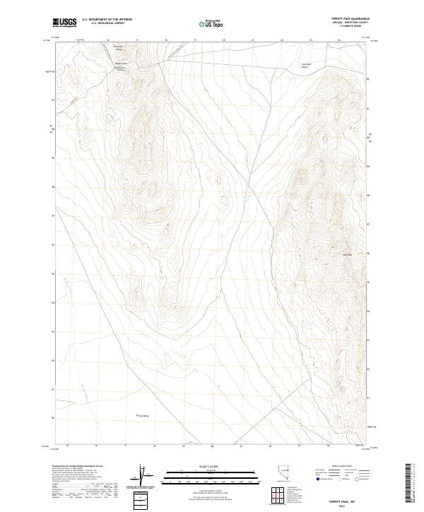
2021 Map of Tippett Pass
USGS Topo · Published 2021About this map
Tippett Pass Summit serves as a high-altitude crossing within the Antelope Range, overlooking a vast basin-and-range landscape in eastern Nevada. This high-desert terrain is characterized by the divide between the Antelope Valley to the east and Spring Valley to the west. Water movement across this arid environment is traced by ephemeral features like Antelope Valley Wash and Spring Valley Cr, which illustrate the natural drainage patterns of the Great Basin. Access through this isolated territory is maintained by a sparse network of county infrastructure, including White Pine Co Road 34 and Tippets Rd. The presence of the Red Hills in the southeast provides a distinct topographical landmark, rising above the valley floor to frame the eastern edge of the pass.
Find a feature on this map
17 named features on this map. Tap any name to fly to it.
Don’t see what you’re looking for? This feature index may not catch every label — zoom into the map to look around manually.
Map Details
Editions of this 2021 Tippett Pass Map
This is the sole edition of this map. No revisions or reprints were ever made.
Other maps of this area

1956 · Ely
USGS Topo · 1:250,000

1959 · Ely
USGS Topo · 1:250,000

1963 · Ely
USGS Topo · 1:250,000
1982 · Kalamazoo Creek
USGS Topo · 1:24,000
1982 · Silver Canyon
USGS Topo · 1:24,000
1982 · Stonehouse
USGS Topo · 1:24,000
1986 · Big Hard Pan
USGS Topo · 1:24,000
1986 · Tippett Pass
USGS Topo · 1:24,000
1986 · Grass Valley Wash
USGS Topo · 1:24,000
1986 · White Cloud Point
USGS Topo · 1:24,000