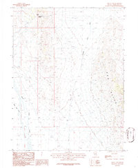
1986 Map of Tippett Pass
USGS Topo · Published 1986About this map
Tippett Pass and Twelvemile Summit anchor this remote high-desert corridor in eastern Nevada as it appeared in the mid-1980s. The landscape is defined by the steep slopes of the Red Hills and the expansive drainage systems that channel seasonal runoff across the basin floor. Braided watercourses like Antelope Valley Wash and the convergent flows of Spring Creek and Snow Bank Creek illustrate the erratic hydrology of this arid environment. Navigation across this isolated terrain relied heavily on a network of 4wd tracks, which provided the only access between the mountain passes and the broad desert flats. The map documents a sparsely developed area where natural landmarks and rugged summits served as the primary points of orientation for travelers and ranchers moving through this portion of White Pine County.
Find a feature on this map
10 named features on this map. Tap any name to fly to it.
Don’t see what you’re looking for? This feature index may not catch every label — zoom into the map to look around manually.
Map Details
Editions of this 1986 Tippett Pass Map
This is the sole edition of this map. No revisions or reprints were ever made.
Other maps of this area

1956 · Ely
USGS Topo · 1:250,000

1959 · Ely
USGS Topo · 1:250,000

1963 · Ely
USGS Topo · 1:250,000
1982 · Kalamazoo Creek
USGS Topo · 1:24,000
1982 · Silver Canyon
USGS Topo · 1:24,000
1982 · Stonehouse
USGS Topo · 1:24,000
1986 · Big Hard Pan
USGS Topo · 1:24,000
1986 · Grass Valley Wash
USGS Topo · 1:24,000
1986 · White Cloud Point
USGS Topo · 1:24,000
1986 · Rock Springs Pass
USGS Topo · 1:24,000