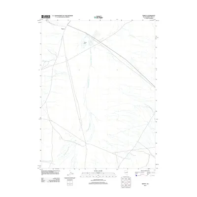
2012 Map of Tippett
USGS Topo · Published 2012About this map
Tippett remains a focal point of this high-desert landscape in White Pine County, situated near the intersection of various ranching tracks and the evocatively named Whiskey Rd. The geography is defined by a network of drainage systems, most notably the Antelope Valley Wash which runs the length of the valley floor, and the ephemeral Chin Creek.
Find a feature on this map
6 named features on this map. Tap any name to fly to it.
Don’t see what you’re looking for? This feature index may not catch every label — zoom into the map to look around manually.
Map Details
Editions of this 2012 Tippett Map
This is the sole edition of this map. No revisions or reprints were ever made.
Other maps of this area

1956 · Ely
USGS Topo · 1:250,000

1959 · Ely
USGS Topo · 1:250,000

1963 · Ely
USGS Topo · 1:250,000

1979 · Sunset Reservoir
USGS Topo · 1:24,000
1981 · Tippett Canyon
USGS Topo · 1:24,000
1981 · Spring Creek Flat NW
USGS Topo · 1:24,000
1986 · Baldy Peak
USGS Topo · 1:24,000
1986 · Tippett Pass
USGS Topo · 1:24,000
1986 · Grass Valley Wash
USGS Topo · 1:24,000
1986 · Rock Springs Pass
USGS Topo · 1:24,000