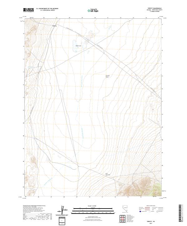
2021 Map of Tippett
USGS Topo · Published 2021About this map
The small settlement of Tippett serves as a remote anchor in the high desert of White Pine County, situated where Pleasant Valley Rd meets White Pine Co Road 32. This 2021 landscape is dominated by the broad expanse of Antelope Valley, a north-south drainage basin defined by the Antelope Valley Wash. To the southeast, the terrain rises sharply into the Kern Mountains, providing a stark topographical contrast to the valley floor. Rare water sources in this arid environment include the ephemeral Tippett Lake and Blind Spring, which were historically vital for ranching and livestock movement through this corridor. The presence of Whiskey Rd and multiple county routes suggests a landscape still utilized for land management and transit between isolated mountain ranges.
Find a feature on this map
14 named features on this map. Tap any name to fly to it.
Don’t see what you’re looking for? This feature index may not catch every label — zoom into the map to look around manually.
Map Details
Editions of this 2021 Tippett Map
This is the sole edition of this map. No revisions or reprints were ever made.
Other maps of this area

1956 · Ely
USGS Topo · 1:250,000

1959 · Ely
USGS Topo · 1:250,000

1963 · Ely
USGS Topo · 1:250,000

1979 · Sunset Reservoir
USGS Topo · 1:24,000
1981 · Tippett Canyon
USGS Topo · 1:24,000
1981 · Spring Creek Flat NW
USGS Topo · 1:24,000
1986 · Baldy Peak
USGS Topo · 1:24,000
1986 · Tippett Pass
USGS Topo · 1:24,000
1986 · Grass Valley Wash
USGS Topo · 1:24,000
1986 · Rock Springs Pass
USGS Topo · 1:24,000