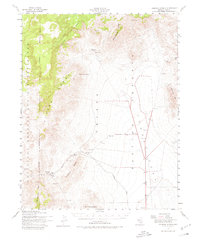
1952 Map of Tippipah Spring
USGS Topo · Published 1980About this map
Nevada Proving Grounds dominates this 1952 topographic study, revealing the early infrastructure of the nation's nuclear testing landscape in Nye County. The map details a transition from traditional desert water sources like Tippipah Spring, Oak Spring, and Captain Jack Spring to a modern military landscape defined by the Las Vegas Bombing and Gunnery Range. Civil engineers and military planners marked the broad expanse of Yucca Flat with the Mercury Highway, a critical artery for the testing operations. The terrain is characterized by stark geological features, including the Eleana Range, Syncline Ridge, and Mine Mountain, which provided the natural backdrop for the era's atomic research and development. An Aqueduct and various water tanks underscore the logistical challenges of maintaining a permanent presence in this arid environment.
Find a feature on this map
45 named features on this map. Tap any name to fly to it.
Don’t see what you’re looking for? This feature index may not catch every label — zoom into the map to look around manually.
Map Details
Editions of this 1952 Tippipah Spring Map
3 editions found

Other maps of this area

1907 · Las Vegas
USGS Topo · 1:250,000

1908 · Kawich
USGS Topo · 1:250,000

1908 · Furnace Creek
USGS Topo · 1:250,000

1908 · Las Vegas
USGS Topo · 1:250,000

1910 · Furnace Creek
USGS Topo · 1:250,000

1942 · Emigrant Valley
USGS Topo · 1:125,000

1942 · Indian Spring
USGS Topo · 1:125,000

1942 · Wheelbarrow Peak
USGS Topo · 1:125,000

1942 · Skull Mountain
USGS Topo · 1:125,000

1948 · Death Valley
USGS Topo · 1:250,000