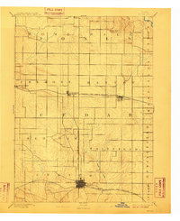
1890 Map of Tipton
USGS Topo · Published 1910About this map
The Cedar County seat of Tipton serves as the primary urban center for this late 19th-century Iowa landscape, where a dense grid of township boundaries and farm roads reveals a highly organized agricultural society. The arrival of the Chicago and North Western Railroad spurred the growth of linear rail towns such as Mechanicsville, Stanwood, and Clarence, each positioned to export grain and livestock to burgeoning Midwest markets.
Find a feature on this map
23 named features on this map. Tap any name to fly to it.
Don’t see what you’re looking for? This feature index may not catch every label — zoom into the map to look around manually.
Map Details
Editions of this 1890 Tipton Map
2 editions found
Other maps of this area

1889 · Tipton
USGS Topo · 1:62,500

1890 · Durant
USGS Topo · 1:62,500

1890 · Tipton
USGS Topo · 1:62,500

1890 · Anamosa
USGS Topo · 1:62,500

1891 · Monticello
USGS Topo · 1:62,500

1891 · Mechanicsville
USGS Topo · 1:62,500

1891 · Wilton Junction
USGS Topo · 1:62,500

1891 · Baldwin
USGS Topo · 1:62,500

1892 · Wheatland
USGS Topo · 1:62,500

1894 · Wheatland
USGS Topo · 1:62,500